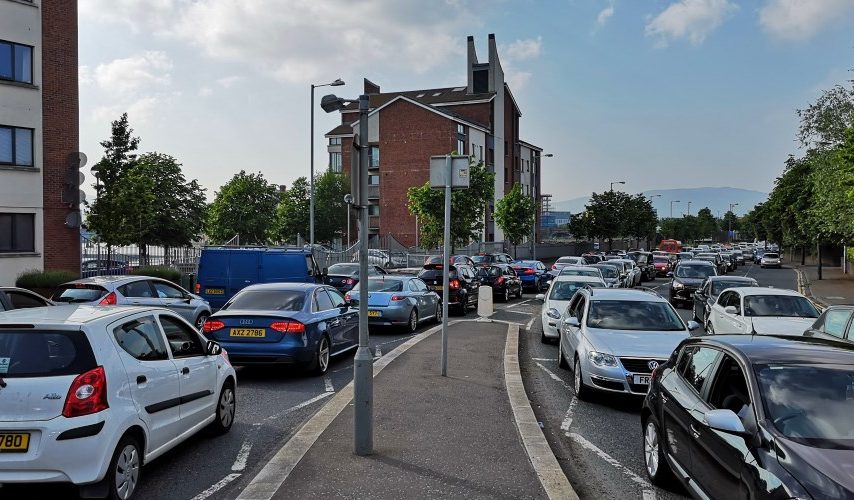
A £400m development in Belfast includes plans to significantly widen a street to as many as SEVEN lanes, in a move which will serve to accommodate more vehicle congestion in the city.
The Belfast Waterside project on the former Sirocco Works site is a 16 acre mixed use development being led by Swinford (Sirocco) Ltd. Documents now available on the Planning Portal website show that as part of various planning applications for the site, significant local road widening is being considered.


The Sirocco Works site was host to a number of industries over the decades – iron foundries, potteries, vitriol works, rope works and glassworks and air conditioning manufacturing. This aerial shot from 1930 shows the site and the associated dense terraced housing in the area – and a narrower Short Strand was recognisable as a street rather than a road – a place for people.
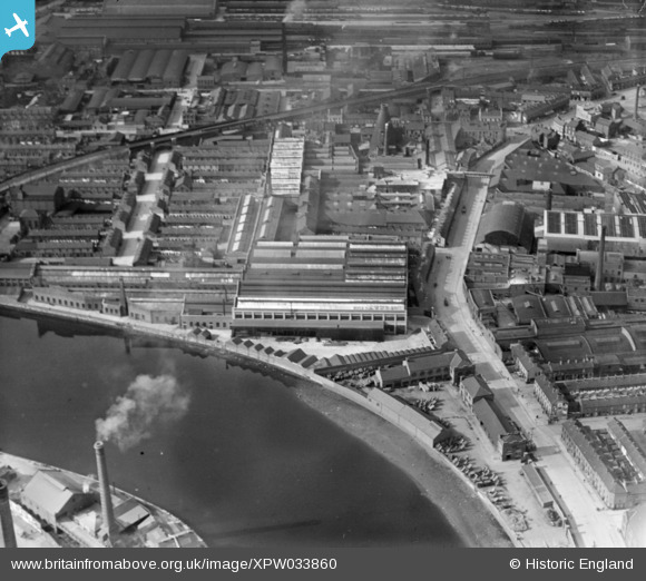
As car ownership grew more popular after the Second World War and land was cleared in the surrounding area – as a result of receding railways, the decline and closure of much of the inner East’s heavy industry, and the poor quality of housing – the Short Strand gradually widened to the 4, 5 and 6 lane through-road it is today.
It now connects two mammoth vehicle junctions – to the south at the Albertbridge Road as it combines 5 major arterial routes, and to the north as the Bridge End has developed into a massive gyratory system to serve the M3, A2, Titanic Quarter, Newtownards Road and bridges to and from the city centre.
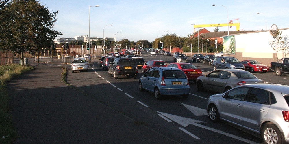
New slip lane planned to the left while the current slip lane will be incorporated into a 3rd ‘straight ahead’ lane
There is virtually no building frontage along this stretch while the few houses which sit on the eastern fringe have a combination of walls and thick foliage to shield them from the carriageway.
In short, over the years it’s been turned into an oversized, intensely busy highway which is hostile to street life – and now it’s planned to be made wider and busier. All just 1 kilometre from Belfast city centre.
Here’s a simplified graphic to demonstrate the scope of the proposed road widening between Ravenhill and Bridge End:
From a 4, 5 and 6 lane set-up now, there’ll be a 5, 6 and 7 lane set-up.
The new northbound third lane will start from as far back as the recently landscaped area at the end of Ravenhill Road, continuing across the Albert Bridge junction, pushing traffic islands and stop lines back, before eating into the pedestrian space on the river side of Short Strand.
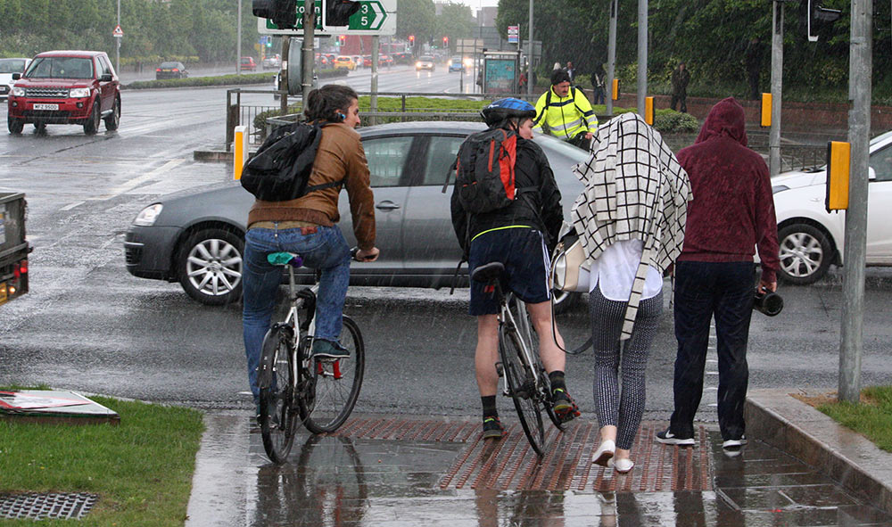
The new third lane will run across where these pedestrians are standing at the Ravenhill Road crossing
The regeneration of the Sirocco site – now called Belfast Waterside – is planned to complete by 2022 bringing “c.5,500 new onsite jobs” with a development outline of:
- 79,500 sq metre of premium office space
- 18,500 sq m hotel & serviced apartments
- Up to 750 residential units including a mix of private, private rented sector and social/affordable apartments
- 12,500 sq m of other uses including local retail, services, community, cultural and leisure
- New pedestrian/cycle bridge over River Lagan
- Moorings in River Lagan
- Areas of public realm
- Roads and infrastructural work
- Parking (basement and deck)
The potential impact on transport around the site was recognised in the recent consultation exercise:
“Traffic congestion and parking were raised as potential issues. The multi-storey car park is no longer included as parking is now incorporated into the design of buildings with basement and podium parking integrated across the site. Through traffic is kept to main routes only, with an increase in pedestrian only and shared space incorporated into the scheme.”
Belfast Waterside Consultation Banner 2 (Phase 1)
A previous planning application had an approved level of trips to and from the site:
AM – 490 (arr) 605 (dep)
PM – 755 (arr) 679 (dep)
The latest application, just dealing with the office developments, has a much lower trip profile:
AM – 393 (arr) 35 (dep)
PM – 29 (arr) 313 (dep)
This begs the question of why northbound vehicle capacity on Short Strand needs to be increased by 50%? Has it already been locked in as a planning condition and can this be reversed?
“The surrounding road network has been tested for robust conditions under the extant approval and whilst some mitigation works in the form of an additional lane along Short Strand, were proposed and conditioned, the remaining road network was shown to operate within capacity with the full extant approval constructed and operational.”
Transport Statement March 2018
And on a simpler note, has the Department for Infrastructure already given their blessing to the widening?
Comment
First up, it’s good to see the old Sirocco Works site moving forward – with the right balance of social housing and private residential, office space, green space and other interesting uses, it can be a real asset to the city. What it shouldn’t do is drag us back to the dark ages of road engineering.
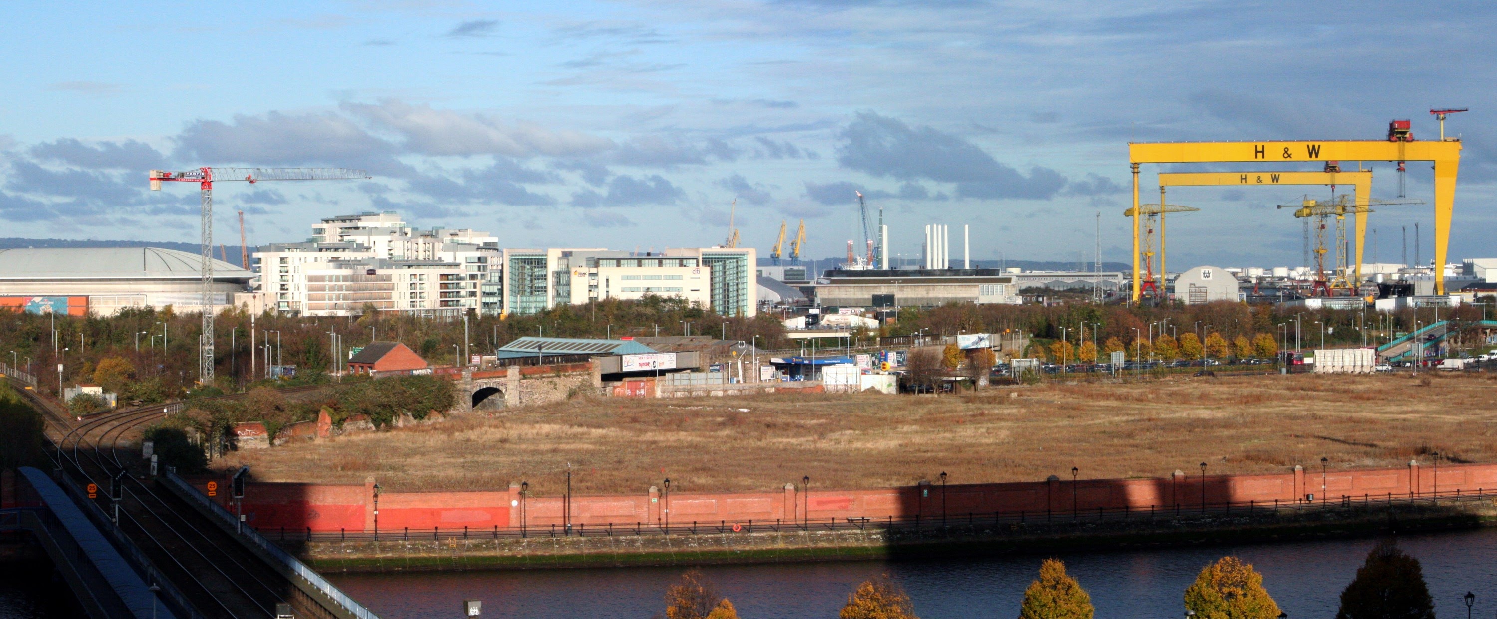
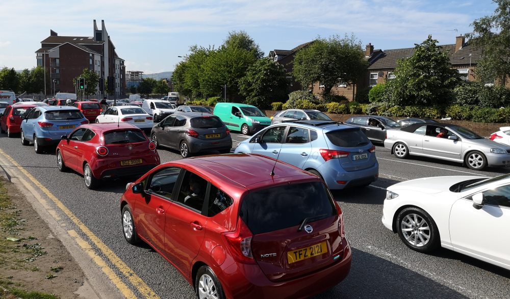
Belfast has major problems with congestion, widely acknowledged to result from too many people driving cars. Despite years of fine rhetoric about getting people into buses, trains, on bicycles, walking and so on, when it comes to the real world, more road space is the always first instinct.
We’re an addict city trying to break a damaging habit but reaching for the same fix again and again.
So Belfast Waterside is now a big test for Belfast City Council and the Department for Infrastructure – what is the strength of conviction on reducing the reliance on car travel?
The phenomenon of induced demand is well-known to anyone who deals in transport matters. The theory in this instance is that the resident and temporary population of the Belfast Waterside site needs additional road capacity for car travel, to make it practical and attractive to drive to and from the site.
The reality is that more road capacity makes car travel more attractive to anyone considering a journey in this area. Additional space fills up (and in this case is likely to jam up immediately) and we’re back to square one, only with more vehicles slowing choking the residents of (the wider community of) Short Strand and Belfast Waterside.
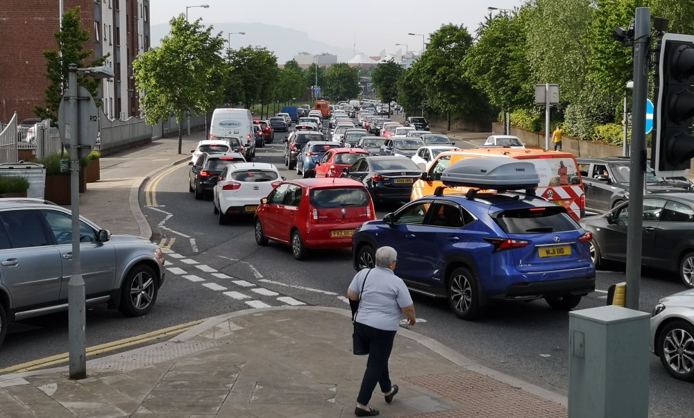
Instead of the current five lanes at this exit point there will be seven – a recipe for more congestion
The opposite phenomenon is reduced demand – take away road space and you make driving less attractive. Traffic isn’t simply displaced to surrounding streets; people actively make the choice to avoid car travel in the area or to switch modes.
There are broadly three options to deal with traffic on Short Strand:
- Reduce the number of lanes and junction loading expansions – humanise the street and actively try to break the stranglehold of vehicles
- Retain the road as it is, understanding that traffic is already at saturation point which in itself should discouraging more car journeys
- Expand the number of lanes to either squeeze more traffic through or naively assuming that free-flow running can be achieved
The first option is the most politically difficult, the second acknowledges the problem albeit from the perspective of your head in the sand and the third is straight from the Robert Moses playbook of how to ruin cities.
Indeed expanding to a six and seven lane highway along this stretch has eerie echoes of the Belfast Urban Motorway plan which proposed running along the footprint of the Short Strand:
And much of this from the Belfast Urban Area Plan 1969 (Central Area report) wasn't implemented… pic.twitter.com/P2Akpku54e
— Andrew McClelland (@IHBCni) June 1, 2018
What are the alternatives to road widening which should be given much greater weight?
Bus
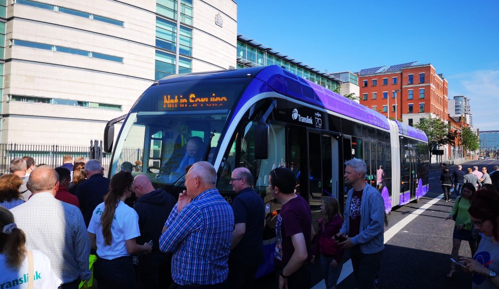
Belfast Waterside is on the eastern Glider route, a £90m bus rapid transit project launching in September 2018. There are several Metro services on both sides of the scheme boundary. The hub of most bus services in the city, Belfast City Hall, is less than one kilometre away, to be linked directly by the new pedestrian and cycle bridge.
Train
There are train stations just 300 metres from both the southern and northern ends of the site. The choice to point Belfast Waterside’s new traffic-free bridge across the Lagan due west to the Waterfront means the quickest way to Lanyon Place Railway Station is 500m walk over the existing railway bridge, under East Bridge Street and through the back door. The Sirocco Skyway idea made this an iconic direct connection into the new development right from the front door, and was a direct 300m – a huge opportunity inexplicably spurned.

Bikefast’s suggested iconic ‘Skyway’ linking Belfast Waterside with Belfast Central Station and the Comber Greenway
Bicycle
There is the traffic-free National Cycle Network running on the scheme boundary linking Lisburn 11 miles to the south and Newtownabbey 7 miles to the north. On the opposite side of the Bridge End gyratory is the Middlepath cycleway which will link the site with the Connswater Greenway, the Comber Greenway fully 7 miles east to Comber and (hopefully) a Sydenham Greenway out to Holywood. The Belfast Bikes scheme is likely to feature at least one new station here, opening access to the inner city core and most public transport nodes.
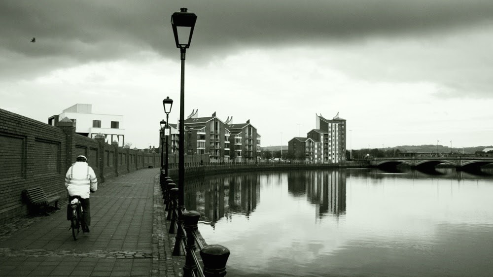
But no cycling infrastructure is planned along Short Strand. In fact:
“There are no proposed improvements to the external existing cycling provision as part of this proposal.”
Transportation Statement March 2018
How easily street space can be found when vehicles need it, but space “constraints” are typically the first barrier thrown up against new cycling schemes.
Squeezing more traffic through this funnel will disproportionately affect existing residents of the Short Strand community and new residential tenants of Belfast Waterside.
It’s simple human nature than during major congestive events, which are becoming very common here, drivers exiting south from Belfast Waterside who find their route blocked will opt to use Mountpottinger Road as a rat run in great numbers. Air quality is already poor here, and will worsen. The Short Strand community who want to have a stake in the Sirocco site and to feel more connected to the Lagan will find themselves with a greater physical barrier to that vision.
If major developments like this don’t have a clear focus to buck trends in car usage – somewhere between 60% (Belfast, all journeys) and 81% (all NI, travel to work) of local journeys – then Belfast will never begin to tackle its chronic congestion problems. And when the proposed 5, 6 and 7 lane set-up grinds to a halt, the only logical answer from the powers-that-be will be widening to a 6, 7 and 8 lane Short Strand.
Belfast Waterside’s proximity to alternative travel hubs means it has all the tools at its disposal to be the change we need – but it looks to be settling for the usual failures, and could drag this part of Belfast down with it.
More information
- Belfast Waterside official development website.
- Scheme planning application (LA04/2018/0448/F) on the Planning Portal website.
- Detailed coverage of the Belfast Waterside Project on the Future Belfast website.
- Belfast Urban Motorway information on the Northern Ireland Roads website.
- Short Strand short changed (Northern Ireland Greenways website).

