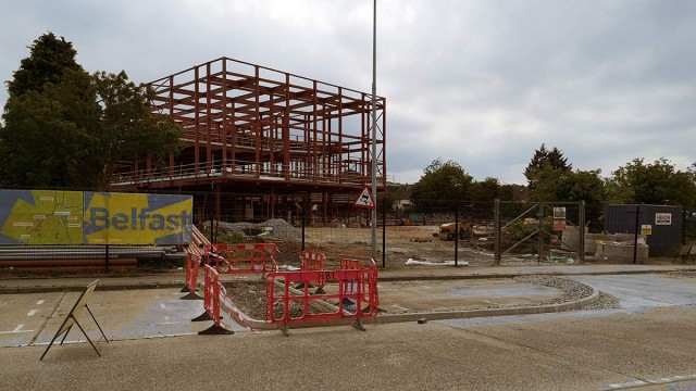
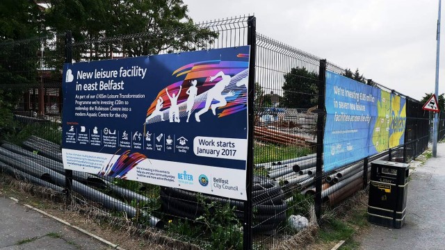
The redevelopment of the Robinson Centre in East Belfast is an open goal for the Department for Infrastructure to create a high quality cycling route.
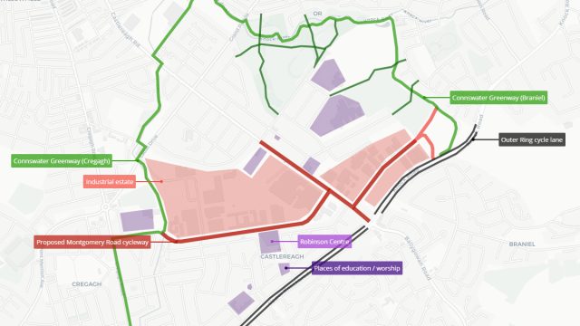
This £20 million leisure facility upgrade, being led by Belfast City Council, is situated on Montgomery Road – right in the middle of the two southern ends of the Connswater Community Greenway.
Linking these two traffic-free paths, with the highest quality cycling link yet seen in Belfast, would multiply active travel options for a large swathe of the local population, and not just for leisure centre visitors.
The area
Montgomery Road divides Lisnasharragh estate (about 5,000 residents) from the Castlereagh industrial estate (about 4,000 jobs).
Major employers include:
Along Montgomery Road are major retail stores such as:
There are five education hubs with hundreds of students:
- Belfast Metropolitan College
- Castlereagh Nursery School
- Grosvenor Grammar School
- Lisnasharragh Primary School
- Orangefield Primary School
And several places of worship including:
- Glenburn Gospel Hall
- Glenburn Methodist Church
- House of Worship
- Orangefield Presbyterian Church
- St Finnian’s Parish Church
- St John’s Orangefield Church of Ireland
In short, although Montgomery Road isn’t a major arterial route, there are a large amount of complex and varied journeys around this route.
The plan
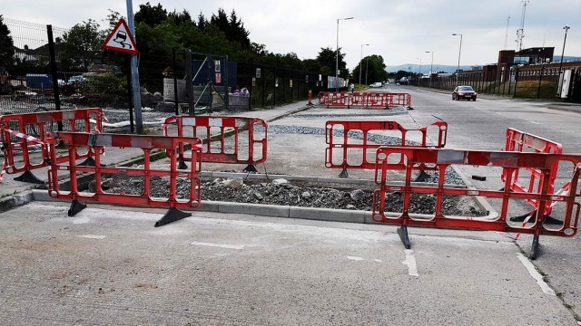
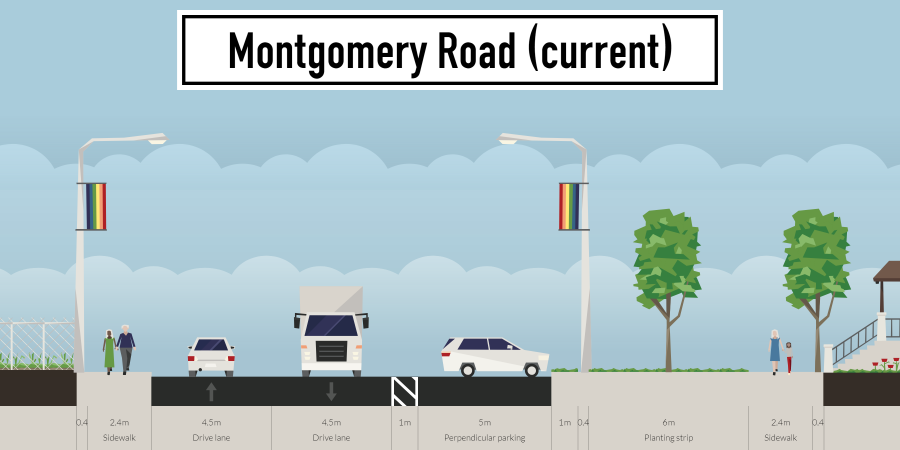
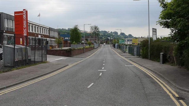
The footprint of Montgomery Road itself is crazy wide – explore it here on Google Maps.
It’s fully 28 metres between boundaries along the main 800m straight run.
A line of over 200 perpendicular car parking bays cuts between the generously wide carriageway and some excellent green space. This free parking is used by employees of the local industrial units (despite generous on-site car parking areas) and the Robinson Centre (where the new development will specifically cater for on-site parking).
Space for cycling development is not a problem at all – this is the cleanest of slates.
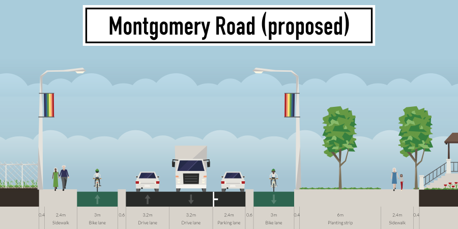
Reconfiguring the roadspace to support active travel is a simple matter of:
- reducing the width of the running lanes
- moving from perpendicular car parking to parallel parking bays
- creating protected with-flow cycleways on both side of Montgomery Road
Cycleways on each side of the road, encouraging with-flow cycling, can help to alleviate some conflicts at side entrances which two-way cycleways (such as on Sydenham Road) can create. Building good capacity now for growing cycling levels later is worth doing – and since space is available, there’s no reason not to do it here.
Continuing this cycling route from the end of Montgomery Road to the Braniel side of the Connswater Community Greenway may seem a challenge, but several interesting options are available.
Prince Regent Road is well-known in East Belfast as a Royal Mail collection point for undelivered parcels. However at the seeming dead-end of the road, local workers have cutely maintained an informal pathway up to the Knock dual carriageway.
This video shows the route in its entirety along with the informal path across the fields to Braniel.
Formalising this route by creating Connswater-standard greenway connection paths would provide an excellent link for Braniel residents to the wider greenway network heading west.
Prince Regent Road itself would need work to create safer space for non-motorised users, looking at pavement widths, side entrance visibility and speed reduction measures.
Cycling route development would need to continue along the Castlereagh Road to link up to the outer ring junction and down to the churches at Orangefield and St John’s – providing the crucial link into Grosvenor Grammar School and Orangefield Primary School. This can enable safe cycling for parents and pupils to create a genuine active travel alternative to the car-dominated school run.

21 months since publishing a draft, the Department for Infrastructure has still not published its final Belfast Bicycle Network Plan. Despite that frustrating delay, this project can stand on its own and start now.
DfI’s first cut of a network amounted to 128km, which they expect will take 10 years to build. A 600m cycleway on Middlepath Street was due to take 3 months, was then stretched to 6 months, and now is into its 9th month with no end date announced.
@deptinfra
New cycle lane at Middlepath street – ? missing some road markings and bike traffic lights on the city bound side of the motorway junction. Dangerous for anyone new to the area/junction. Clear road markings on the opposite side. pic.twitter.com/OtKVjWdqmg— Saban (@sm_mawh) September 4, 2018
Montgomery Road could be a proper test run for DfI to be more efficient. That would require DfI to:
- quickly consult on route options and a design framework now
- set a deadline for completion of summer 2019 to match with the opening of the Robinson centre
- investigate the temporary use of armadillo separation for the longer stretches to save time and money
With no residential properties facing onto Montgomery Road, objections should be light. Off street parking is perfectly catered for in the new leisure centre, the industrial estate and the residential estate.
How about even using the same mechanism by which private taxis were to be dumped into bus lanes – the Experimental Traffic Scheme – to quickly deploy these cycleways for a set test period?
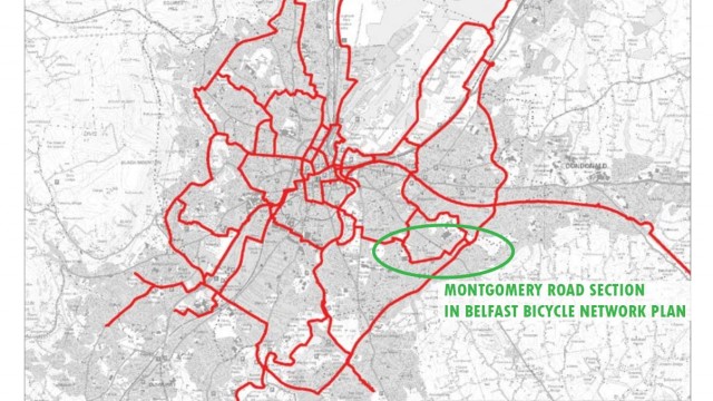
Show us how agile you can be – Montgomery Road is even in your draft Belfast Bicycle Network Plan:
The ducks couldn’t be lined up any better.
Whatever shape that plan for Belfast takes, there are real questions over just how fast DfI can deliver projects. In Seville they built 50 miles of cycleways in one year. The 600 metre Middlepath Street may take the same time at this rate. That’s an embarrassment which DfI should be seeking to wipe away quickly.
The Montgomery Road cycleway plan demonstrates how Belfast can and should build more dense cycle networks around existing cycling routes. Separate people from vehicles on higher volume and speed streets and allow quieter streets to then be shaped to the needs of people over vehicles. Enable people to travel between important community nodes by bicycle. And don’t leave a major new leisure facility with the only reasonable way to reach it being by car.
Here’s an easy opportunity for a test run for long-term cycling development in Belfast – will you take it?


